
Sentinel Hotspots provides an important and consistent overview for management of fires across the country. The system was developed in the mid-2000 through a collaborative effort between Geoscience Australia, Australian Geospatial-Intelligence Organisation and CSIRO Land and Water. The system monitors hotspots nationally and provides timely hotspots information to its end-users. Sentinel has been a valuable input into the tools used by government and private agencies managing fires in Australia.
Sentinel hotspots are point data, derived from (a growing number of) satellite-born instruments that detect light in the thermal wavelengths. Typically, the satellite data are processed with a specific algorithm that highlights areas with an unusually high temperature.
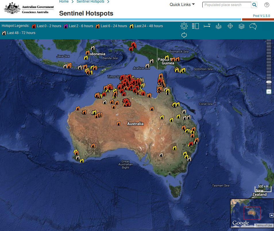
A number of land management and emergency response agencies have taken data feeds from the Sentinel system to imbed into their routine fire management operations enhancing their situational awareness programs to assist staff, managers and the community. Hotspots data when merged with other spatial information provide a strategic picture to land managers; which allows them to understand the implications of a particular fire as well as to target resources.
Overall the Sentinel Hotspot Dataset goes back to August 2002 (27th) and contains more than 4.4 million records, with data from a range of satellites including MODIS (from 27 August 2002) AVHRR (from 19 October 2006) and VIIRS (from December 2013).
GA provides documentation on the Sentinal Hotspot products here (PDF). There are different ways and formats to access and visualise the actual hotspot data:
Norman Mueller is GA’s data mentor for GovHack 2015 - you can contact him with any questions about accessing these services.